Lost in Translation at 9,000 Feet: Decoding Japanese Trail Signs on Kiso-Ontake
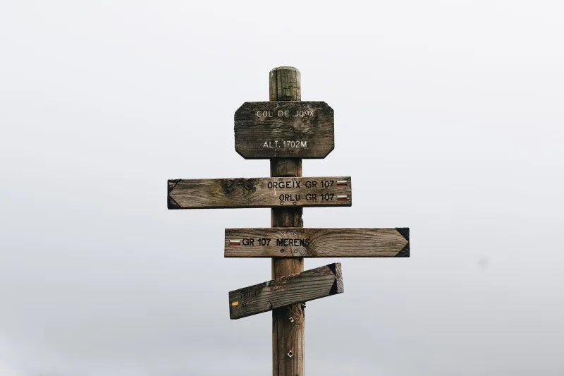
Let's be honest: most American hikers can read a USFS trail junction in their sleep. Brown sign, white blaze, mile marker, done. Then you land in Japan, walk up to the trailhead at Otaki, and find yourself staring at a weathered wooden post covered in characters you can't pronounce, next to a map that reads right-to-left, with a box that says something about writing your name in it.
Don't panic. Japanese trail signage is dense, but it's also incredibly consistent—learn about a dozen characters and a few systems, and you'll navigate Kiso-Ontake as confidently as you would the Appalachians. Here's the field guide I wish someone had handed me at the trailhead.
The Six Kanji That Matter Most
You don't need to read Japanese. You need to read mountain Japanese. Memorize these:
- 山 (yama) – mountain. Appears on virtually every summit sign. If you see 御嶽山, you've made it.
- 頂 / 峰 (chō / mine) – summit, peak. 諸峰 on a sign means "various peaks," a heads-up that the ridge continues.
- 登山道 (tozando) – hiking trail / mountain-climbing route. This is your "trail this way" marker.
- 危険 (kiken) – danger. Often paired with 立入禁止 (no entry). When both appear together, turn around. Japanese closures are not suggestions.
- 休 (yasumi) – closed or rest. A sign reading 頂上休止 means the summit area is off-limits, usually volcanic or weather-related.
- 分 (fun) – minutes. Trail signs give time, not distance: 頂上まで90分 = 90 minutes to the summit.
That last point is the big adjustment for American hikers. Japanese trail signage measures everything in time, not miles, and it's calibrated to the average local hiker. If the sign says 90 minutes and you're doing it in 75, great. If it says 90 and you've been walking three hours, you've missed something—go back.
The Yama-Note: Japan's Route Card System
At most trailheads you'll find a box or board with 登山計画書 (tozan keikakusho) printed on it—your route plan card, or yama-note. Fill in your name, route, planned descent time, and contact info, and drop it in the box before you start. Some trailheads have you take a tear-off tag; others ask you to submit the form online via the Compass app or a similar service.
Coming from the US, where you just... start hiking, this feels bureaucratic. It's not. It's the reason a missing hiker on Kiso-Ontake can be located within hours rather than days. Fill it out every time, even for the standard Otaki route. And when you summit, some mountains have a stamp or tag system to confirm you made it—use it.
Reading the Weather Signals
Kiso-Ontake is an active volcano, and signage reflects that. Along the approach you'll pass posts with volcanic warning levels—a numbered system (1 through 5) posted by the Japan Meteorological Agency. Level 2 means stay off crater approaches; Level 3 or higher and the trail is typically closed outright. Check the JMA website the night before, in English, rather than relying on trailhead signs to break the news.
Also learn 雷雨 (thunderstorm)—afternoon electrical storms are the single biggest hazard on this mountain in summer, and the standard Japanese hiking rhythm of "start at dawn, summit by ten, descend by two" exists entirely around avoiding them. Adopt it.
When the Trail Disappears Into the Mist
Above the tree line, Kiso-Ontake's upper slopes are volcanic scree and weathered rock, and the trail is marked with painted rock markers and occasional rope lines rather than the painted blazes you know from the AT or PCT. In clear weather, route-finding is straightforward. In fog—and it rolls in fast—it's a different animal.
The protocol:
- Stop moving the moment visibility drops. The markers are close together; losing the line takes seconds, relocating it takes much longer.
- Look for the rope. Sections of the upper route have fixed ropes or chains, and they're deliberately placed along the correct line. Follow them.
- Use your GPS track, not your sense of direction. Download an offline map before you leave Wi-Fi—Yamap and YAMARECO are the standard Japanese apps, both with English interfaces, and both show live locations of other registered hikers. On a foggy day, that feature alone is worth the download.
- Turn back without ego. The mountain has been there for a thousand years of pilgrims. It'll be there next weekend.
One more cultural note: if you do get turned around and encounter other hikers, asking "sumimasen, michi wa?" (excuse me, the trail?) plus a hopeful gesture works on every mountain in Japan. Someone will help. Someone always does.
Your Pre-Hike Checklist
- Offline map downloaded (Yamap or YAMARECO)
- Yama-note filled out and submitted
- JMA volcanic warning and weather forecast checked
- Six key kanji screenshotted to your phone
- Headlamp, layers, and enough water for a longer day than planned
None of this is complicated. It's just different from what you know—and that difference is part of what makes hiking a sacred Japanese mountain feel like genuinely traveling somewhere, instead of just doing a longer version of a trail back home. Learn the signs, file the card, and go enjoy one of the most atmospheric summits in the country.